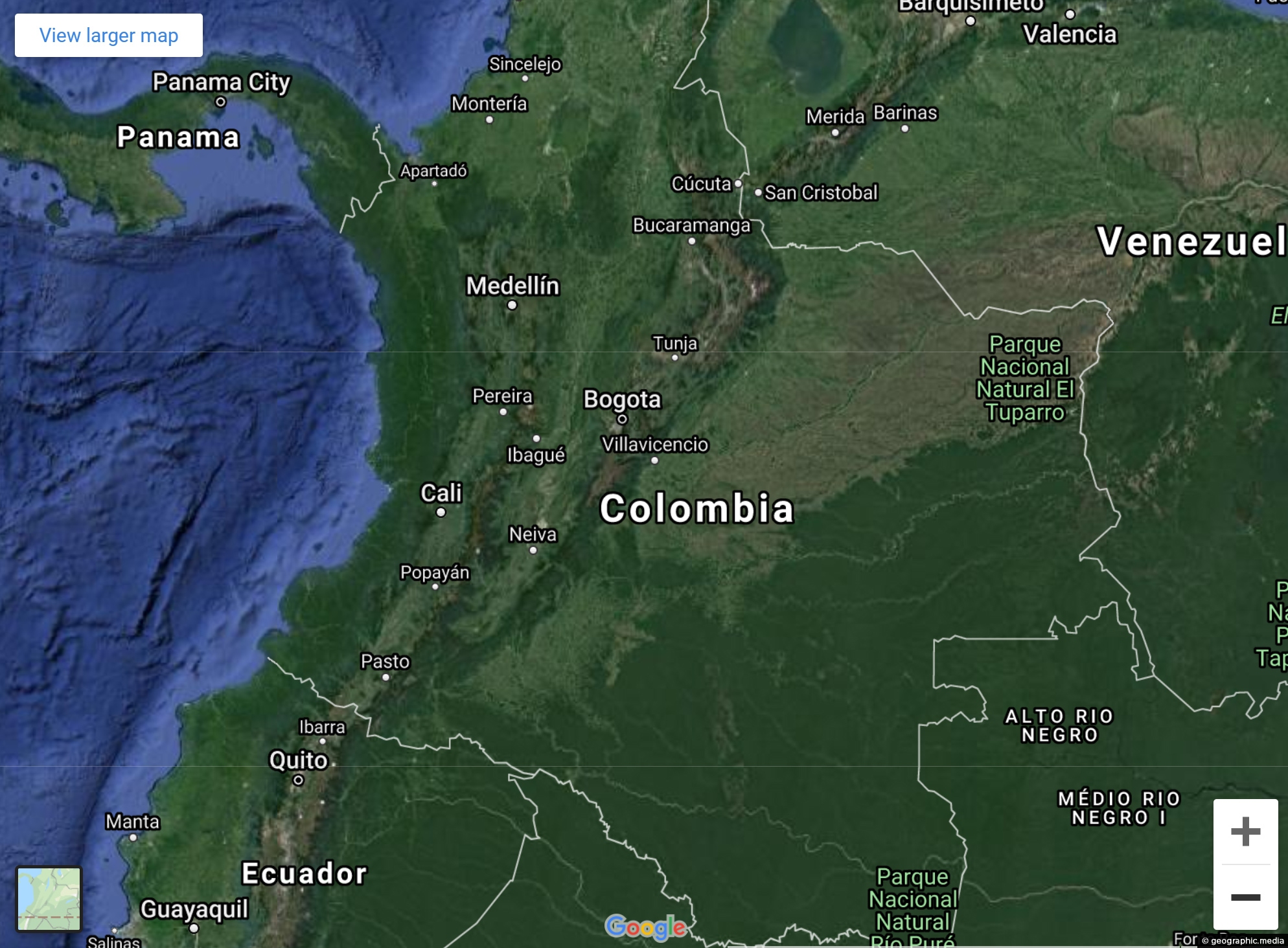
View Larger Map Explore Colombia’s varied landscapes and city streets using our Google Map and Street view. Both satellite...
Colombia Maps
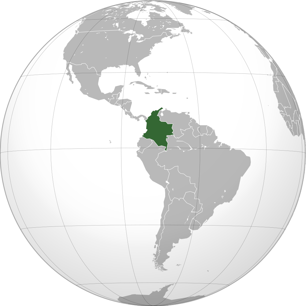
Map of the globe with the location of Colombia highlighted on the South American Continent. Colombia borders the Pacific...
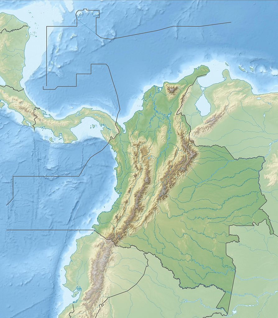
This map shows the Andes within Colombia. The mountain range splits into three ranges giving the country large amounts...
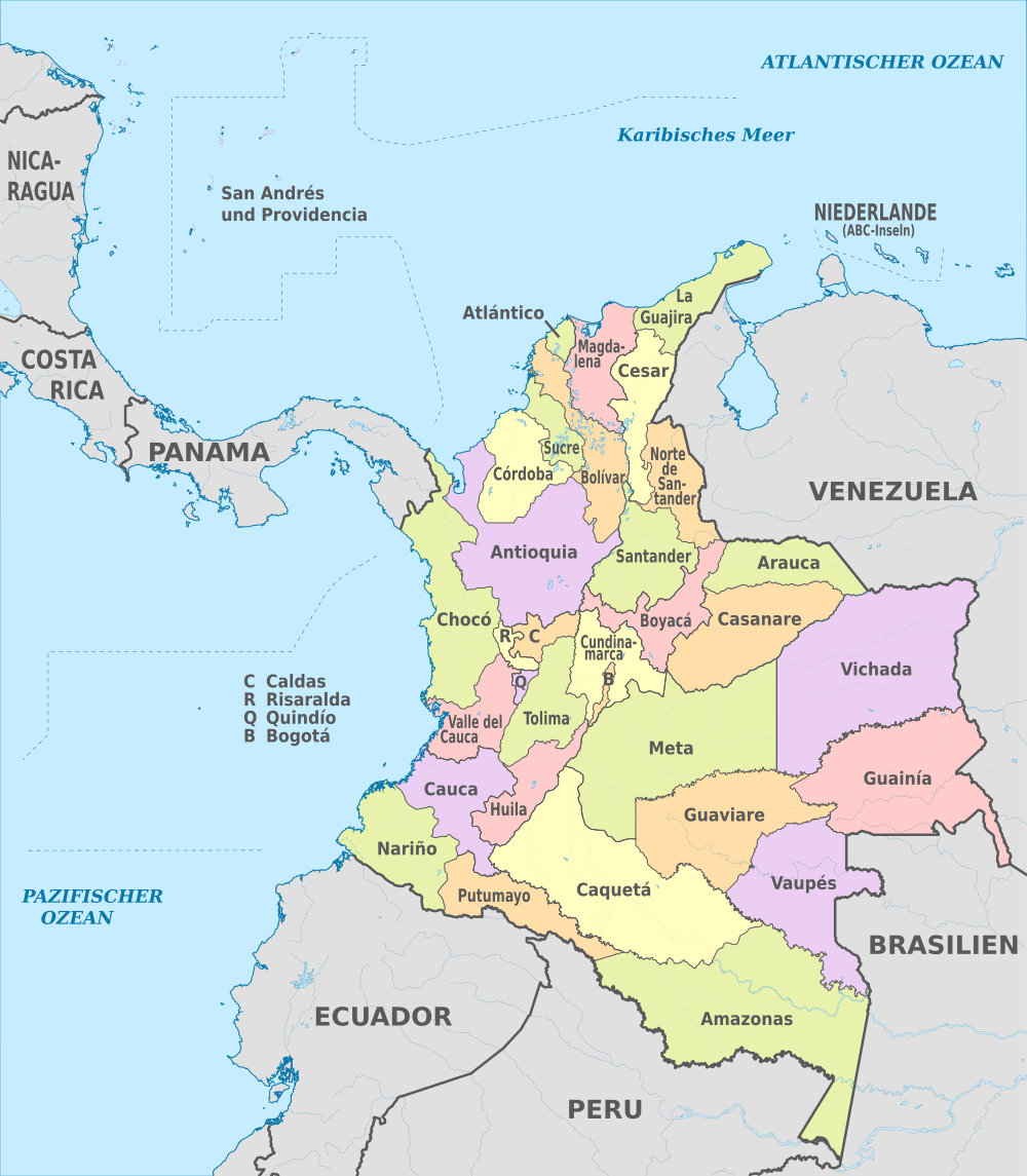
Colombia is divided into 32 departments and one capital district. Each department has a local government which is headed...
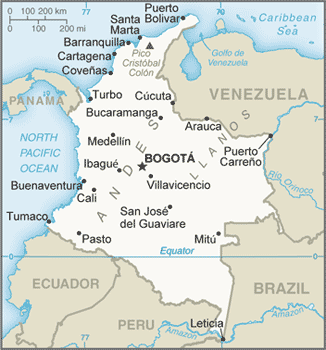
Map showing the main cities of Colombia as well as the surrounding countries, oceans, and seas.
Latest Posts
Browse by Date
M | T | W | T | F | S | S |
---|---|---|---|---|---|---|
1 | 2 | 3 | 4 | 5 | 6 | 7 |
8 | 9 | 10 | 11 | 12 | 13 | 14 |
15 | 16 | 17 | 18 | 19 | 20 | 21 |
22 | 23 | 24 | 25 | 26 | 27 | 28 |
29 | 30 | 31 |
Popular Posts
- Awakening New Zealand video (100)
- Iguazu Falls as seen from Brazil (86)
- Metrocable Medellin (77)
- Spinnaker Hill View (68)
- Spinnaker Hill in Whitby Porirua (68)
- Pauatahanui Inlet (68)
- View from Whitby (68)
- The Devil’s Throat (62)
- Aerial View of Iguazu Falls (61)
- Porirua Harbour & Papakowhai (57)
- Lake Wakatipu (57)
- Salto Rivadavia & Iguassu River (56)
- Lake Tekapo & Lupins (54)
- Cascadas at Iguazu (53)
- Close up of Salto Rivadavia (53)
- Salto Rivadavia Misiones Province (53)
Subjects
AccommodationAnimalsArchitectureBeachesBirdsBoatsBridgesBuildingsCarsChurchesCitiesCoralCultureExtra Wide HorizontalFlowersForestsHarborsHomesIslandsLakesLandscape / HorizontalMapsMenMonumentsMountainsPalmsParksPeoplePlantsPortrait / VerticalRiversRoadsRuralSeaShopsSkyscrapersSnowSunsetsTownsTrailsTransportTreesVideosVolcanicWaterfalls
Recent Comments